
The Times contributes LAFD fire stations to OpenStreetMap
All 106 L.A. city facilities added to open-source database
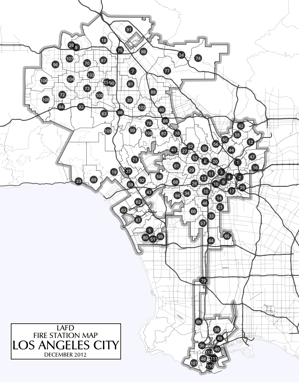
The Times has contributed data about all 106 fire stations operated by the Los Angeles Fire Department to OpenStreetMap, a free and open-source database of geographic information.
The contributions were made according to rules outlined in OpenStreetMap’s drive to better map the world’s fire stations.
The outline of each station was traced from Bing Maps’ satellite imagery, as allowed by Microsoft. Names were standardized to match Fire Department style. The LAFD was listed as each station’s operator. Street addresses were reconciled with the official LAFD list.
The exception is Fire Station 80 at Los Angeles International Airport, which does not yet appear in Bing’s satellite imagery and could not be traced as a polygon. It is recorded as a point, but its metadata were expanded the same as other stations.
Outdated points from the GeoNames database were deleted from OpenStreetMap. Other LAFD-related buildings were also added, including the 911 dispatch center, the African American Firefighter Museum, the Hollywood firefighter museum, the retired station near Florence and Western avenues and the historic station downtown where “Ghostbusters” was filmed.
The data were collected as part of The Times’ ongoing investigation of the LAFD, which began in March following the admission that for years fire officials released flawed figures overstating how fast rescuers arrived at emergencies. That project has yielded a series of data-driven stories about the department’s performance.
This blog has previously written about the technical methods used to conduct our investigation and released the base layer created for an interactive map of response times.
What you can do
If you want to help improve fire station data in OpenStreetMap, you could:
- Add fire stations operated by the Torrance Fire Department, which are now missing.
- Trace buildings and standardize metadata for another department near L.A. The Los Angeles County Fire Department’s 164 fire stations would benefit from attention.
- If you’re not from Los Angeles, improve the fire stations where you live.